We have evidence that people have lived in
South Carolina for more than 10,000 years.
Most of the clues that help us understand
their lives can be found in archaeological
sites. An archaeological site is any place where
physical evidence of past human activities
exists. Sometimes the only information we
have about people or an event is preserved
in the ground. Remember that most of the
history of the United States happened before
there were written records.
Archaic Shell Rings and Middens
Lighthouse Point Shell Ring
Open to the public
Archaeologists believe Native American shell rings mark occasions when people came together to celebrate and feast. Researchers found three shell middens and evidence of several houses at Parrot Point. They believe the people who lived here were part of a community that lived around Charleston Harbor 4,500 years ago. In addition to hundreds of pounds of oyster shells, researchers found thousands of artifacts including pieces of pottery, bone pins, and shell beads.
COLONIAL ERA
In 1671 the new Grand Council of Charles
Towne ordered the creation of a town on
James Island. James Towne was to be laid out
in G-acre town lots with 10-acre planting
lots. No evidence of the town has been found.
Instead James Island remained sparsely
populated until the early 1700s. The first
settlers established homes and farms along
the island’s rivers and streams. They used
locally made boats to travel between the island
and Charleston.
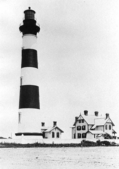
Morris Island Lighthouse
1750 E Ashley Ave. Folly Beach, SC
Open 6 AM to 8 PM (by boat only)
The first lighthouse was built on Morris Island about 1767 by the Royal Colony of South Carolina. It was one of the first lighthouses constructed on the East Coast. The black and white striped lighthouse you see today was built in 1846. The lighthouse is made of brick and is 150 feet tall. It ceased to be an official navigation aid in 1962. Morris Island has severely eroded and is only accessible by boat because no bridge serves this island.
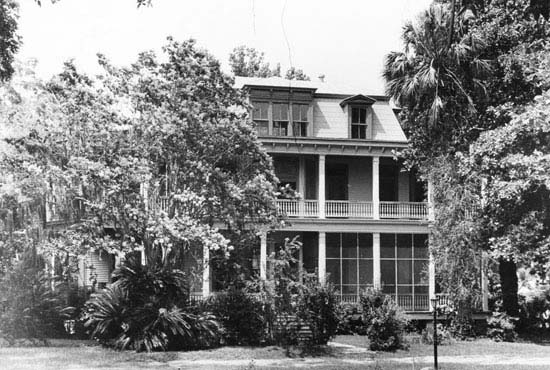
Stiles-Hinson House
90 Paul Revere Drive
Private Residence, No Public Access
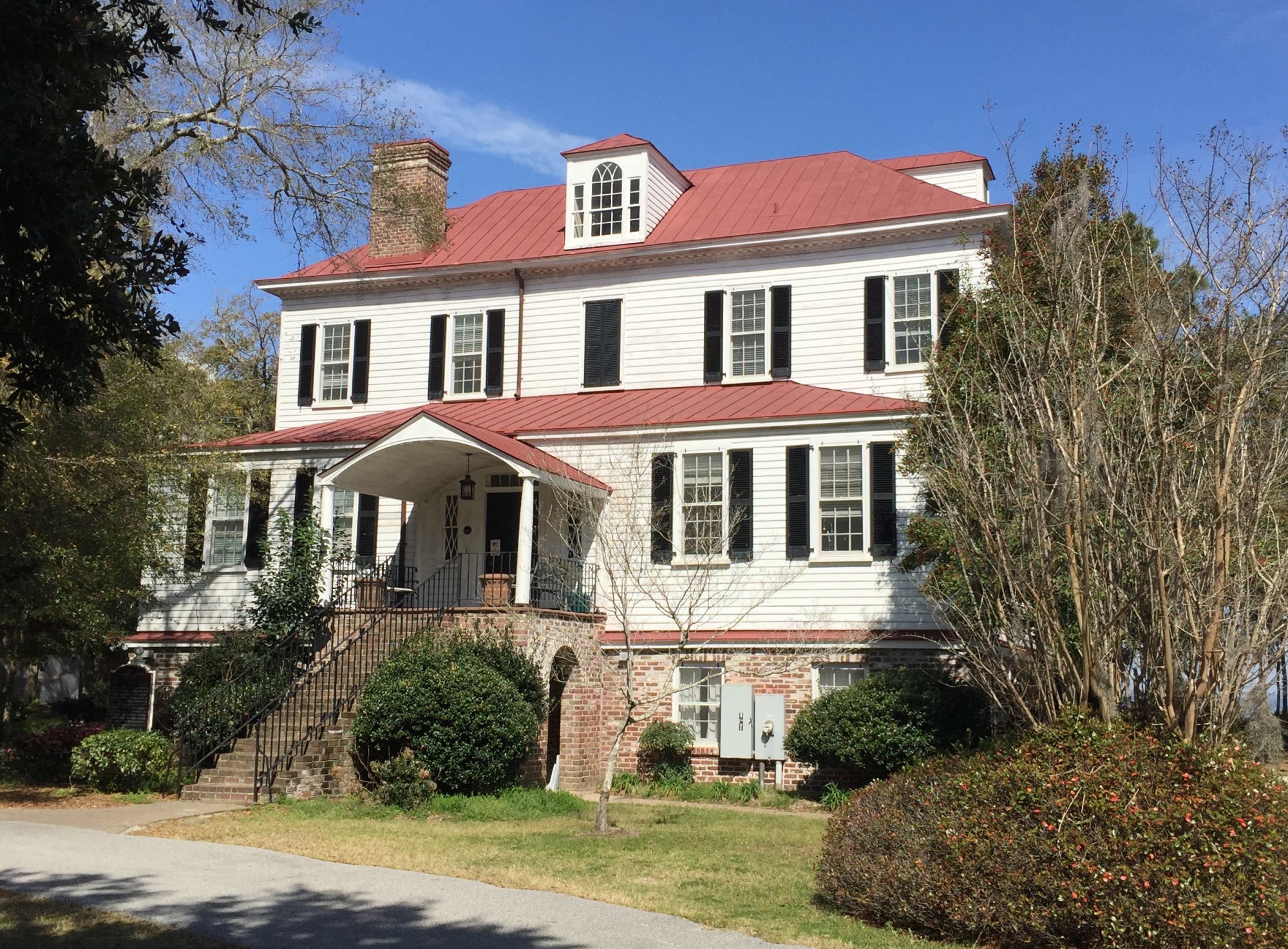
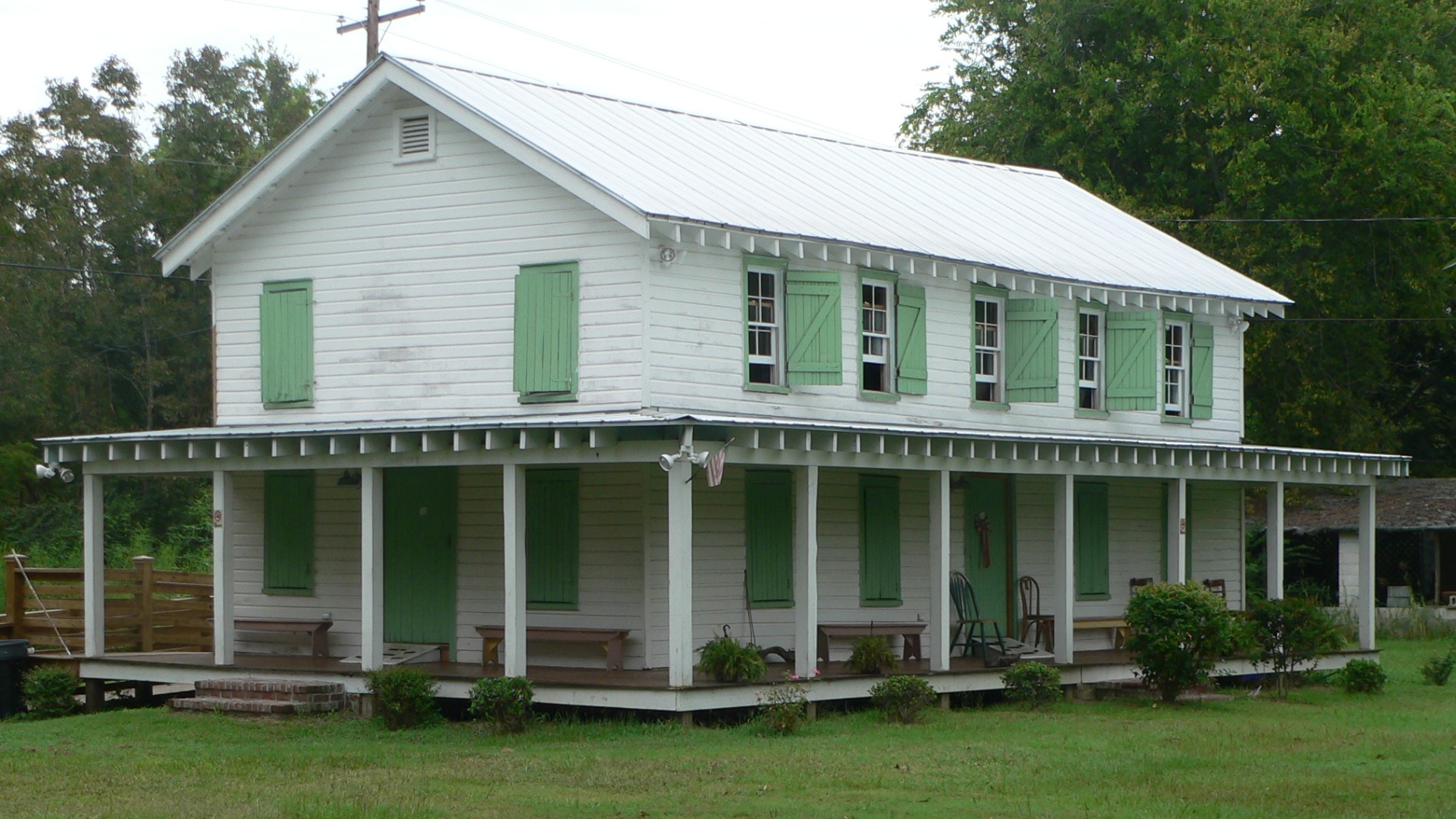
The Stiles-Hinson House consists of two houses built back to back. The first house was built in 1742 by Benjamin Stiles. Stiles fought against the British during the American Revolution. The second house was built in the late 1800s by William Godber Hinson. It was constructed in a Victorian style, a mansard roof, and decorative wood elements. The Plantation was actively farmed until the early 1960s.
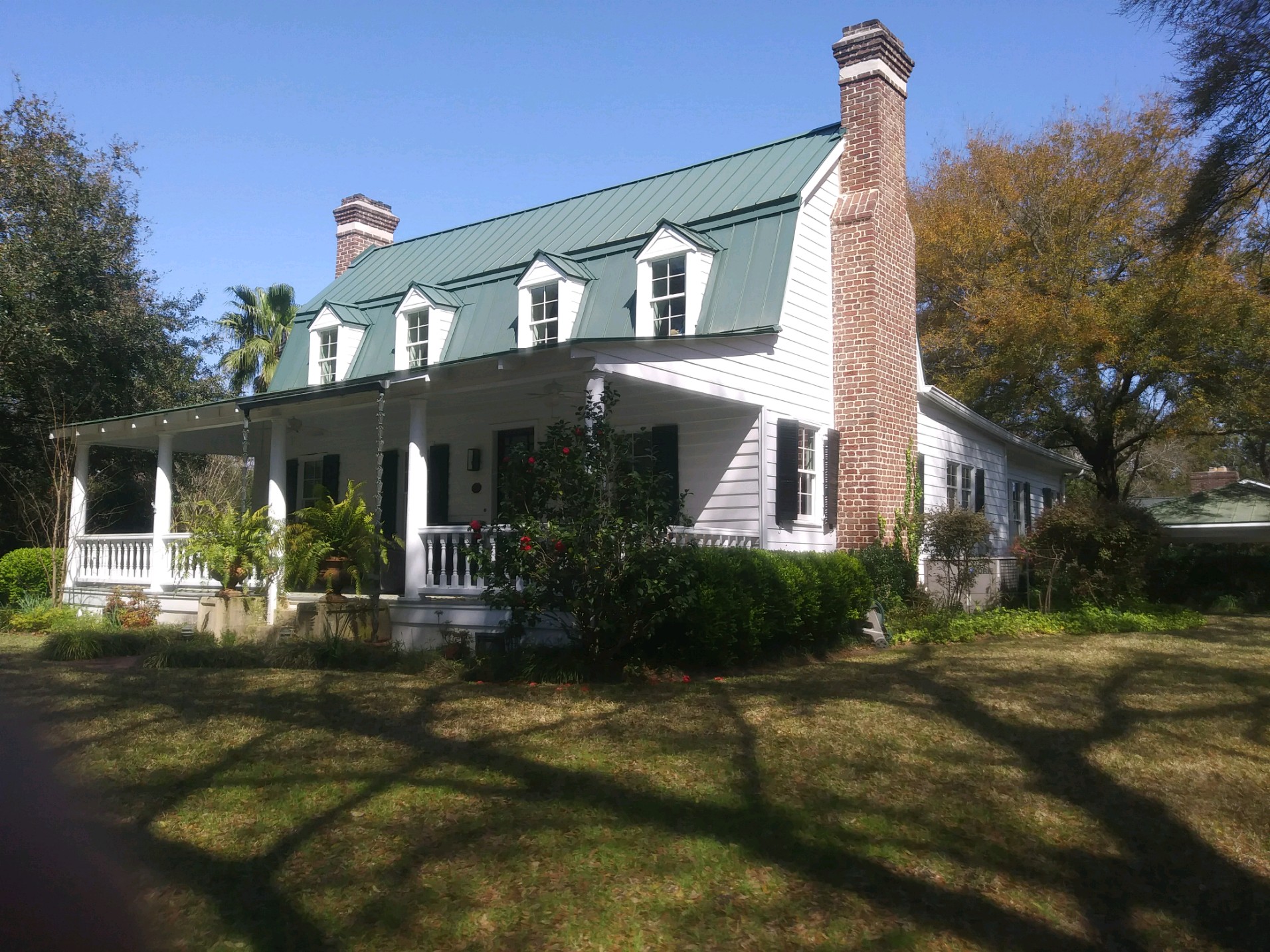
Cuthbert-Heyward House
683 Fort Sumter Drive
Private Residence, No Public Access
This may be the oldest house still standing on James Island. It was built about 1740 for Hester Heyward, the widow of Captain Thomas Heyward. In the early 1900s the property was part of Lawton Plantation. By this time a kitchen had been attached to the house and a rear addition constructed. The porch roof, columns, and balustrade were added before 1940.
REVOLUTIONARY WAR
When the Thirteen Colonies declared their
independence from Great Britain in 1776,
many prominent citizens supported the
Patriot cause and fought to expel the British.
Despite their efforts, Charleston and the
surrounding area fell to the British in 1780
and were occupied until December 1782.
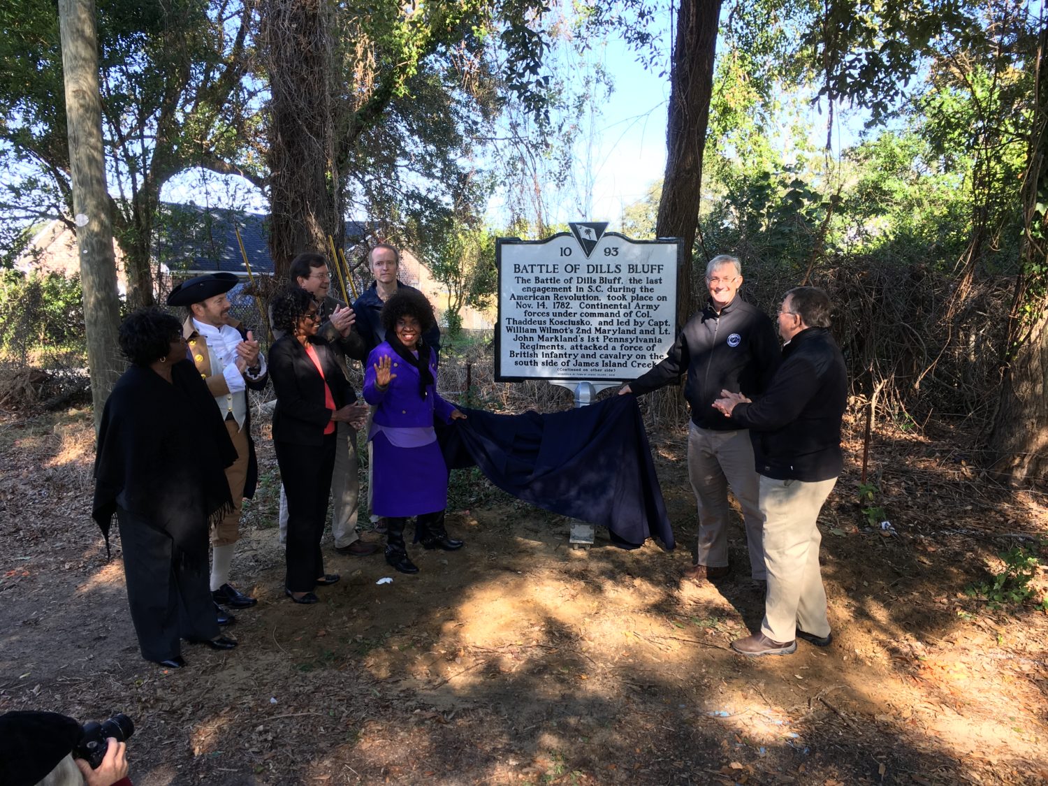
Battle of Dills Bluff
Harbor View Rd. at North Shore Dr.
Charleston, S.C.
Open to the public
The Battle of Dills Bluff was the last Revolutionary Was engagement in South Carolina. On November 14, 1782, a small group of Patriot soldiers attempted to ambush a British wood-cutting party. But the Americans had faulty intelligence; they were outnumbered by the British soldiers. The Patriots retreated, suffering casualties. These men were the last to die in combat in South Carolina during the Revolutionary War. The historic marker marks the approximate area where the battle took place.
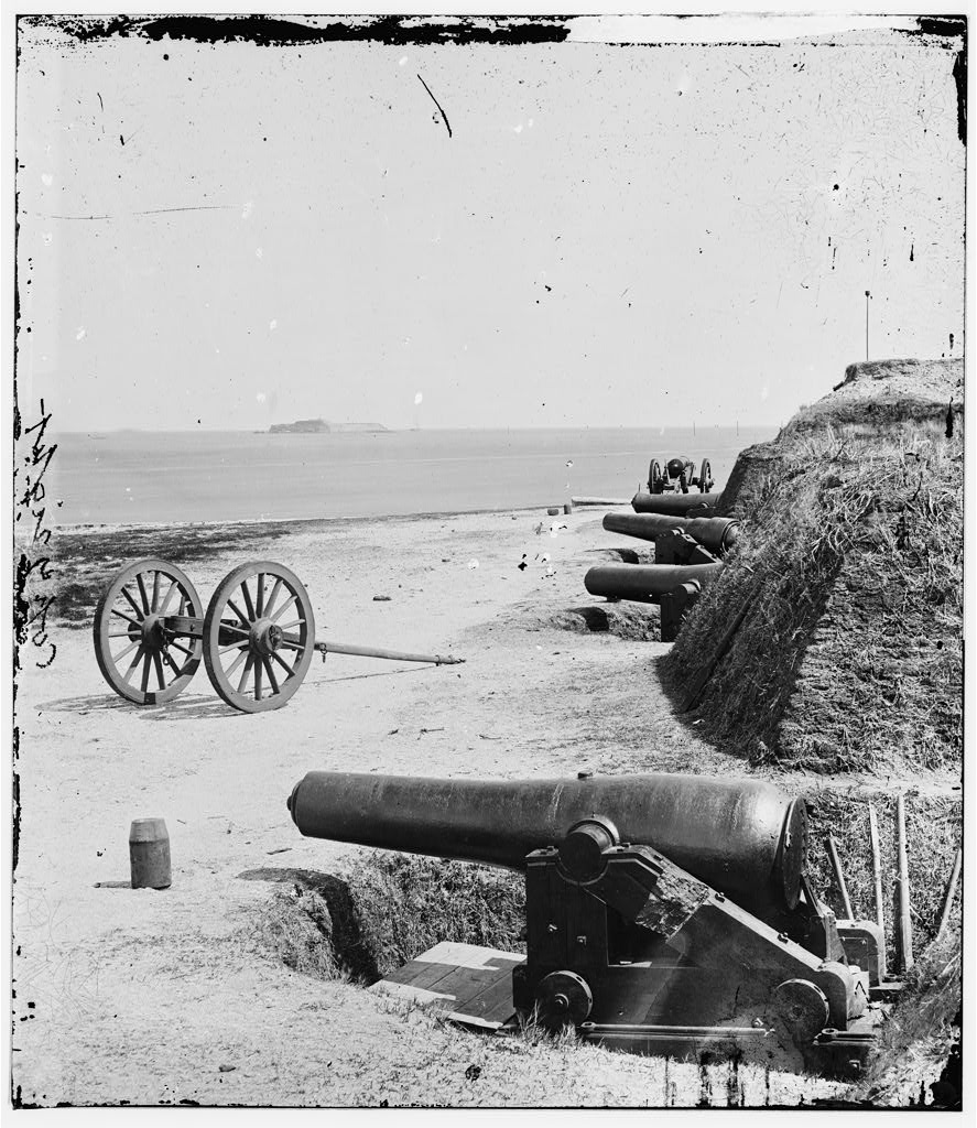
Fort Johnson
End of Fort Johnson Rd.
Open to the public
The first Fort Johnson was built in 1708. It was replaced by a new tabby fort in 1759, fragments of which are still visable. It was manned during the American Revolution, but never engaged the British forces. After the war General Moultrie ordered construction of a new fort, but it was destroyed by a hurricane in the early 1800s. During the Civil War, Confederate soldiers built new earthworks and installed four 10-inch mortars and three guns at the site. On April 12, 1861 at 4:30 in the morning, the first shot of the Civil War was fired from Fort Johnson over Fort Sumter. During the war Union forces made two unsuccessful attempts to capture Fort Johnson. Confederate forces finally abandoned the fort during the Confederate evacuation of Charleston in February 1865. After the Civil War, Fort Johnson served as a maritime quarantine station, as a Coast Gueard billet during World Was II, and now as the College of Charleston's Grice Marine Laboratory and the South Carolina Department of Natural Resources, Marine Resource Division.
THE YOUNG COUNTRY
From 1720 until 1865, the majority of James
Island’s residents were enslaved Africans. Early
in the Colonial Era, they raised livestock, cut
timber, fished, and grew vegetables. In the
1750s indigo was grown as a cash crop. After
the American Revolution, indigo was replaced
by Sea Island cotton. In 1860, 1,533 enslaved
people toiled on the island’s 21 plantations.
Some of the largest plantations were Seabrook,
Hinson, Dill, Rivers, Grimball, Legare, Clark,
and Lawton. There were 193 white residents
on James Island.
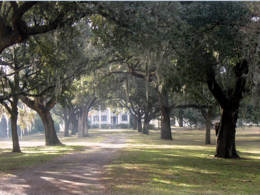
McLeod Plantation
325 Country Club Dr.
Open Tues.- Sun. 9 a.m.- 4 p.m.
The existing plantation house at McLeod was built in 1858 and modified in the 1920s. The six intact cabins lived in by enslaved people likely date to the 1850s. According to the 1860 US census, 115 enslaved people work on the property. During the Civil War McLeod Plantation was used as Confederate Headquarters for James Island; after the island was evacuated in February 1865, as a Union hospital. After the war it became an office for the Freedmen's Bureau.
Grimball Plantation/ Cemetery
1870 South Grimball Rd.
Open to the public
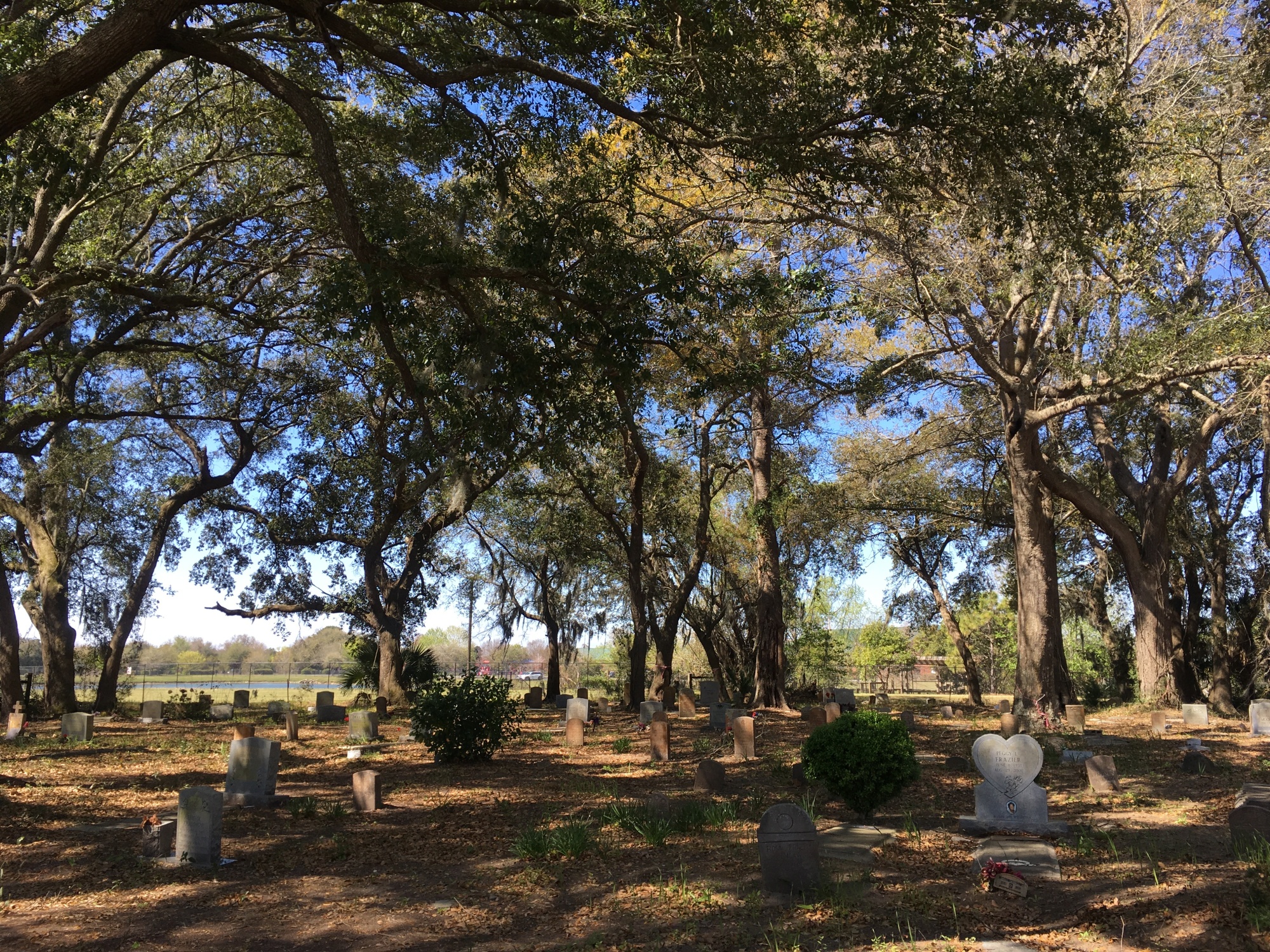
English immigrant Paul Grimball was first granted 1,600 acres of land on Edisto Island in 1682. Along with other Edisto planters, the family began to aquire land on James Island in the early 1800s to grow Sea Island cotton and provisions. The 1860 US Census shows 210 enslaved people lived on the property. Confederate Brigadier General Gist gave the order for all civilians to evacuate James Island. The Grimball family complied, abandoning their property in May 1862. The plantation buildings are no longer standing but the cemetery can still be visited.
Marshlands Plantation House
331 Fort Johnson Rd.
The Marshlands Plantation House was built around 1810 on the Cooper River. Around 1906, the owner, Mrs. Wallace Lawton of Lawton Plantation on James Island, sold the plantation to the United States government to establish the Charleston Naval Shipyard. In 1961, the government proposed to demolish the house to expand the naval yard. Concerned citizens had the house moved by barge to Fort Johnson. Other than location, very little else has changed for the Federal-style house.
FIERY SECESSION
Politicians and most of the free population
in Charleston and on James Island supported
secession and the Confederate government.
Charleston and the lands around the harbor
were under almost continuous attack
from Federal forces beginning on July
10, 1863. Confederate forces tenaciously
defended James Island to protect the city
of Charleston and the harbor. However,
in February 1865 the city surrendered to
the Union army. Confederate forces then
evacuated the entire South Carolina coast
and retreated into North Carolina.
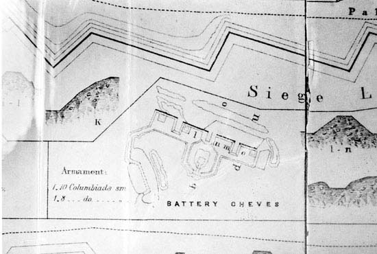
Battery Cheves
851 Robert E Lee Blvd
Open to the public
Battery Cheves was one of five Confederate earthworks built in the summer and fall of 1863 on the southeastern shore of James Island to defend Charleston. These batteries were built after Union forces occupied Folly Island and captured most of Morris Island. This battery was named for Captain Langdon Cheves, a Confederate engineer killed at Morris Island in 1863. The small, limited remains of this site may only be viewed from the road (no parking available).
Battery Haskell
End of Schooner Rd.
Open to the public
Battery Haskell helped defend Confederate-held Battery Wagner by shelling attacking Union forces during the summer of 1863. Originally it contained 12 artillery emplacements. Battery Haskell was named for Captain C. T. Haskell, Jr. who was killed in action at Battery Wagner on July 10, 1863. The small, limited remains may only be viewed from the road (no parking available).
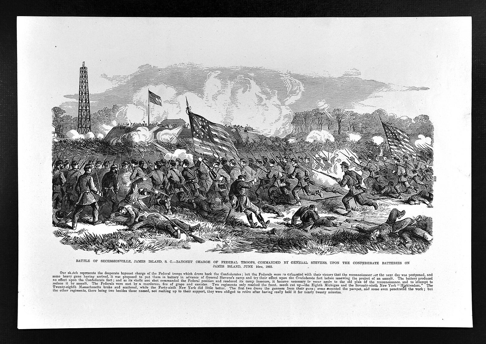
Fort Lamar Heritage Area and Secessionville District
1231 Fort Lamar Rd
Open to the public
In June 1862, Union troops landed from the Stono River at Grimball Plantation and on the west end of Sol Legare Island. They marched to attack fortifications west of Secessionville, later named Fort Lamar. The Confederate army defeated the Union army, causing heavy casualties. Union forces retreated, leaving behind many of their dead. They evacuated most of the wounded to Union camps near
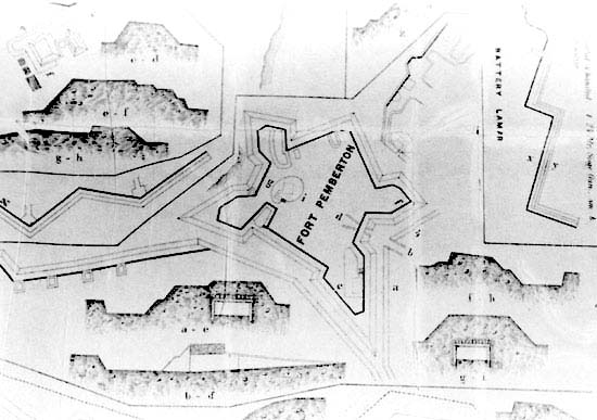
Fort Pemberton
221 Yates Avenue
Open to the public
Fort Pemberton was a large, enclosed, five-sided Confederate earthwork completed in 1862. The design was unusual. Normally only masonry fortifications of this period featured this plan. It was constructed on the Stono River to prevent the Union navy from accessing Charleston Harbor through Wappoo Creek and Elliott Cut. The fort was abandoned when Confederate forces retreated from Charleston in February 1865.
RECONSTRUCTION
The defeat of the Confederacy ushered in
an era of social and political upheaval. The
South Carolina Constitution of 1868 enacted
democratic reforms and allowed newly
emancipated men to vote for the first time.
Groups of newly emancipated families worked
together to build new communities. However,
the election of Governor Ben Tillman and
passage of the Constitution of 1895 negated
the political and social gains made by
African Americans. James Island adopted the
discriminatory Jim Crow laws instituted across
the South. A segregated community developed
with separate schools, churches, and restaurants
for white and black people.
Pinckney Park
I461 Fort Johnson Rd.
Open daily 8 a.m.- 8 p.m.
Pinckney Park is named for Simeon Pinckney who once owned this property. He was enslaved until the Civil War, when he enlisted in the Union Army as a member of the 3rd Regiment South Carolina Volunteer Infantry (African Descent). They were recruited and mustered at Hilton Head. In 1877 Pinckney purchased 20 acres on James Island and passed his property to his descendants. Much of the land continued to be owned by the family until they sold it to the town in 2015 for use as a park.
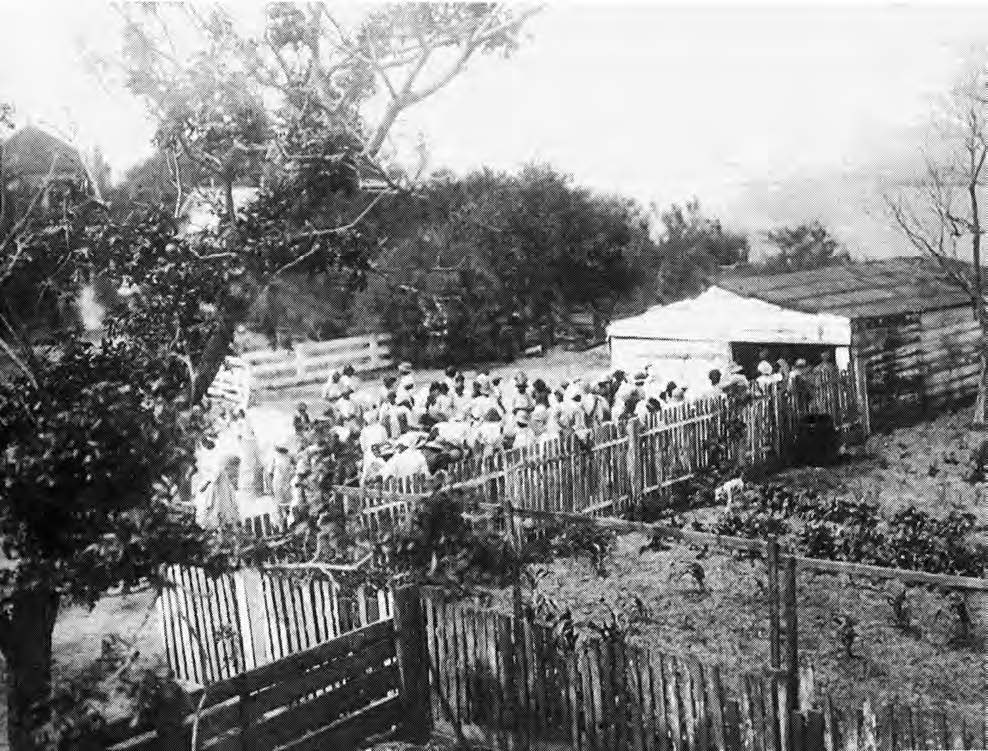
Sol Legare
Sol Legare Rd.
Open to the public
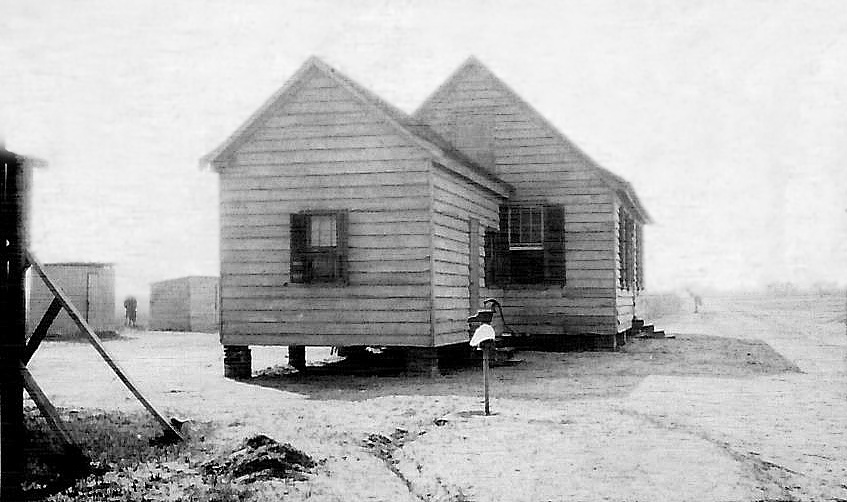
This vibrant African American community was established after the Civil War as formerly enslaved people worked to purchase their own land to farm and build homes. It was laid out in long narrow lots, allowing farmers access to waterways and roads. In 1919, the Sol Legare School opened as a two room schoolhouse with two outhouses and hand pump for water. Today, the school built in the 1940s serves as a community center. Many descendants of the originally property owners continue to make the community their home.
Grimball Farms
1870 South Grimball Road
Cemetery open to the public
Although the Grimball family regained their property after the Civil War, they sold some of the land to freedmen. The new Grimball community was planned in the same way as Sol Legare, with long, narrow lots. By 1880, approximately 10% of the old plantation was owned by African Americans. Evergreen Cemetery is located nearby and may contain unmarked graves of enslaved people who worked on the plantation and their descendants who worked their own farms. The cemetery is still used today.
A NEW CENTURY
World War II and the Civil Rights Movement
of the 1950s and 60s brought more changes
to James Island. Schools and businesses were
integrated. New bridges, paved roads, and cars
brought new people to the island.
Seashore Farmers Lodge
1745 Sol Legare Road
Open to the public, museum by appointment
The Seashore Farmers Lodge was built in 1915 as a lodge hall. It was a hub of this vibrant African American community. An organization of local men formed a community bank to help provide for the residents’ financial needs and to protect against unexpected natural disasters such as hurricanes, flooding, failed crops, sickness, injury, or death. The lodge sustained damage from Hurricane Hugo in 1989 and suffered from disrepair. In 2007, the community worked to restore the building. Today it is a museum and cultural center.
Mosquito Beach
Mosquito Beach Rd.
Open to the public
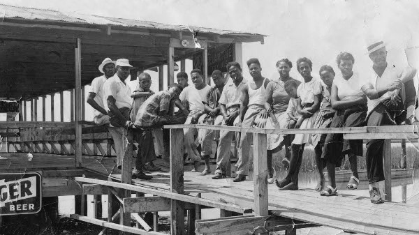
In 1953 Andrew “Apple”Jackson Wilder opened Haborview Pavilion with a lounge, restaurant, and motel at the “Factory", the site of a former oyster cannery. Mosquito Beach, as it became known, offered African American families the opportunity to relax, dance, cool off, and socialize. From 1900 until the mid- 1960s, beaches in South Carolina were segregated. Mosquito Beach was one of five African American beaches around Charleston. African American beaches usually were on rivers or sounds. Prime oceanfront areas were reserved for whites. Today, Mosquito Beach remains an important part of the community.
Little Rock Golf Club
Grimball Rd and Little Rock Blvd.
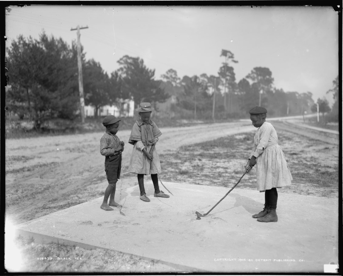
The Country Club of Charleston was a whites-only golf course when it was built in 1926. The only way African American men could access the course was as hired caddies. Richard Smalls, Sr. worked as a caddie before deciding to open his own course. He studied golf course construction and design and purchased eight acres of land in Grimball Farms. Mr. Smalls built a six-hole course with a club house, bar, and eight-room motel. African American men played at Little Rock Golf Club from 1953 until 1961 when the City Municipal course was integrated. There are no known images of the golf club.
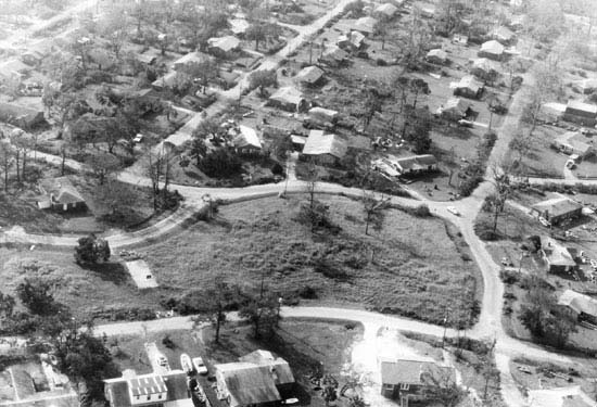
Riverland Terrace
North of Maybank Highway
Open to the public
Riverland Terrace was one of the first modern planned neighborhoods on James Island. Construction started in the 1920s using the most modern design trends including curvilinear street patterns, uniform housing setbacks, and driveways. Because of the Depression and World War II, construction of most homes was delayed until the 1950s.
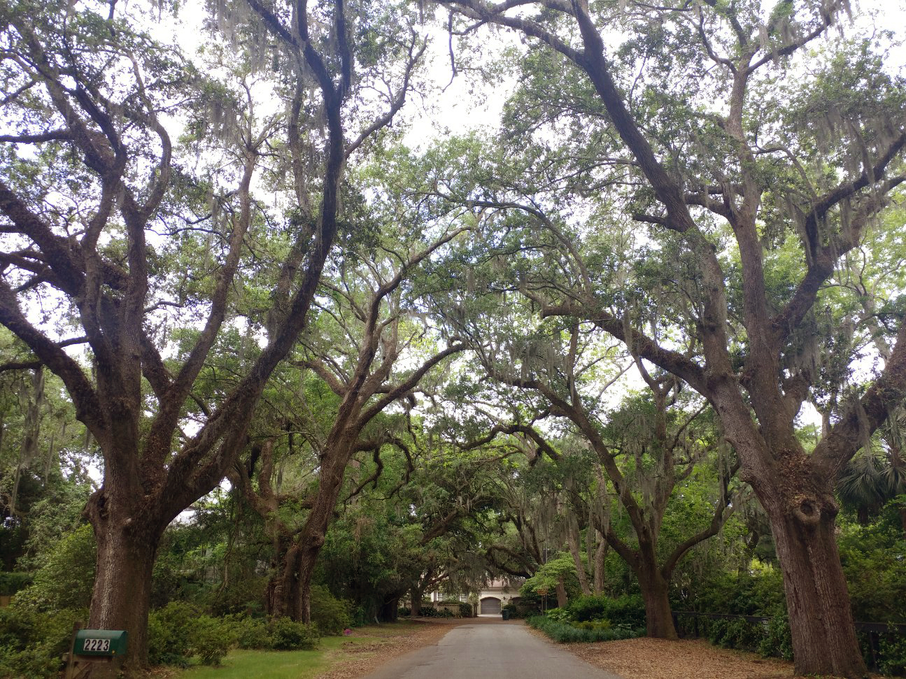
Avenue of Oaks
Wappoo Drive
Open to the public
The allee includes more than 70 grand live oak trees that are over 100 years old. They were originally planted in the 1910s.
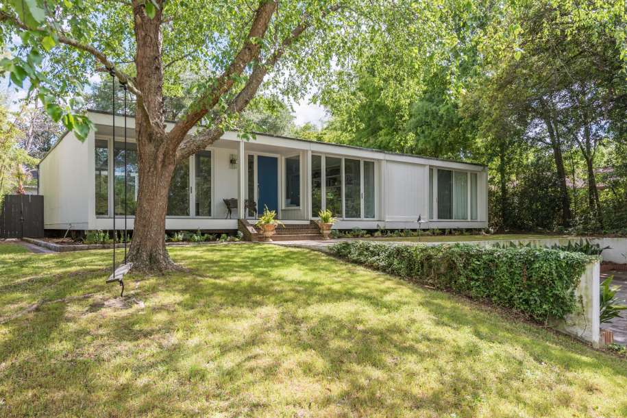
Elliot A. Constantine House
2037 Lakeshore Drive
Private Residence, No public access
This house was designed and built in 1973 in the Modern International Architectural Style by prolific Charleston Architect, Elliott Augustus Constantine, son of renowned architect Augustus Edison Constantine of ‘Constantine and Constantine Architects’. It features walls of glass, a flat rectangular roof, incorporating simple and modern architectural elements. There are very few houses of this style in the Charleston area.
OUR SCHOOLS
The South Carolina Constitution of 1895
established the state’s system of public
education, creating separate schools for
white and black children. However, African
American schools were woefully under¬
funded. In 1954 the Supreme Court ordered
states to desegregate public schools. The
state government tried to build new separate
schools for African American children to avoid
the ruling. Despite the state’s efforts, school
desegregation began in 1963.
James Island Grammar
Fort Johnson Rd. and Dills Bluff Rd
The first public school was established on James Island in 1883 as James Island Grammar School. It was located on the same land as the earlier private planter’s school. Initially, there were only six students, and the school only served white students. The Riverland Terrace School was built in 1930 to serve white students.
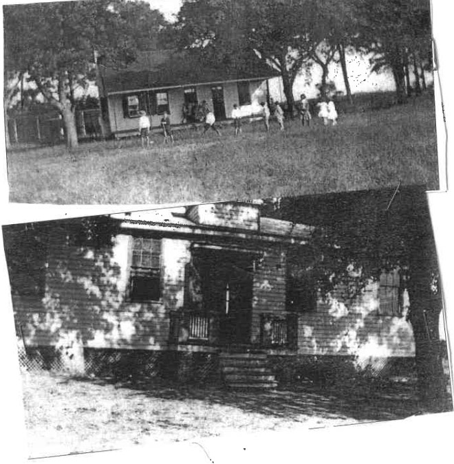
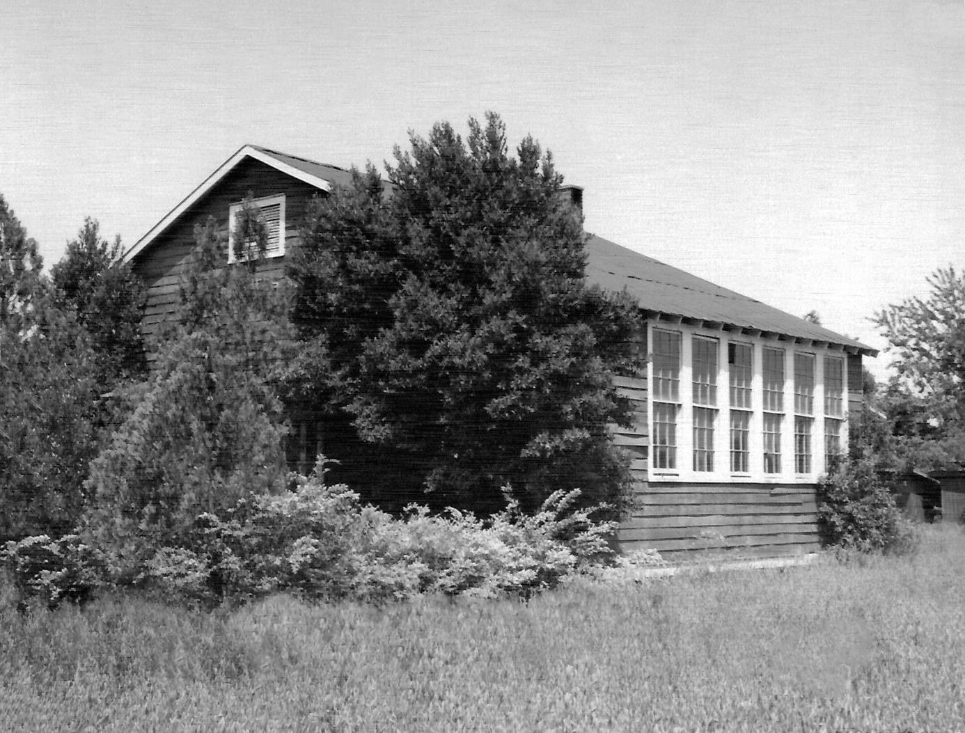
Cut Bridge Elementary School
Riverland Dr. at Camp Rd.
Cut Bridge Elementary, commonly called Old Cut Bridge School, was built on property donated by the Dills family of Stono Plantation. It was a two-room school house that was painted black and located in the middle of low lying marshland. Students had to wade through the water at high tide. Mrs. Alberta Johnston Murray served as the school’s principal beginning in 1926.
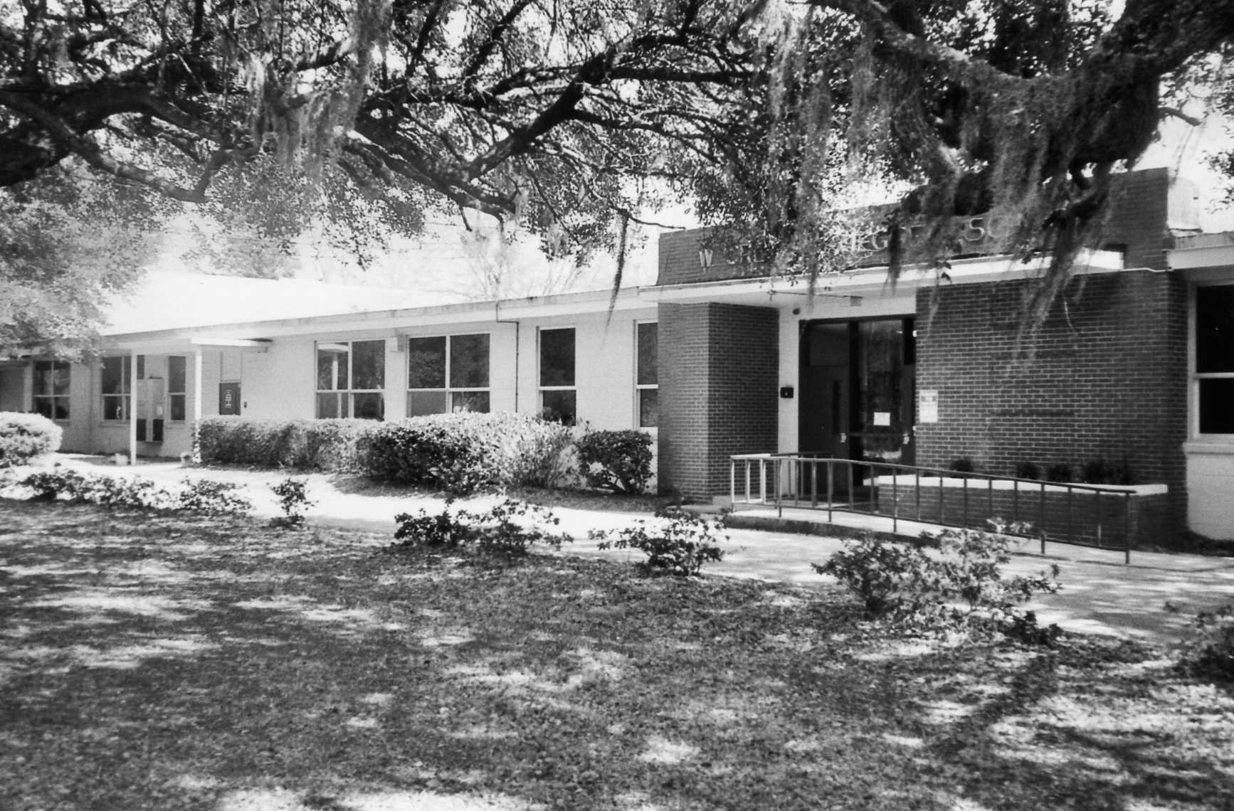
W. Gresham Meggett High School
1929 Grimball Road
W. Gresham Meggett High School was constructed in the 1950s as part of South Carolina’s push to improve schools for African American children and avoid school integration. The school brought higher education for African Americans to James Island for the first time. The new school had modern amenities and taught a wide range of classes James Island High School on Camp Road was the companion, white-only Equalization School.
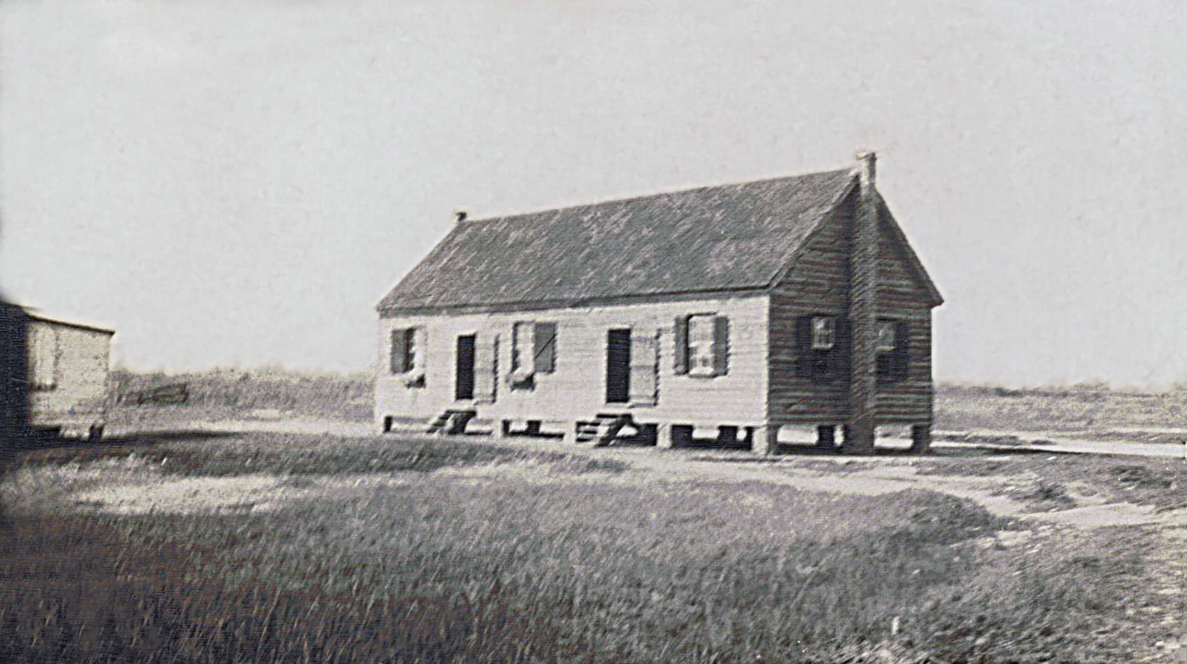
Three Trees School
Fort Johnson Rd. and Champaigne Lane
Three Trees School was established as the only school for children who lived “down the island”. In 1926 Mrs. Fannie Greenwood was hired as the principal to improve learning conditions. She made sure students received a solid academic foundation, teaching black history and nurturing students’ self-esteem. Miss West, a volunteer from Florence, South Carolina, taught students for 40 years in the small black schoolhouse.
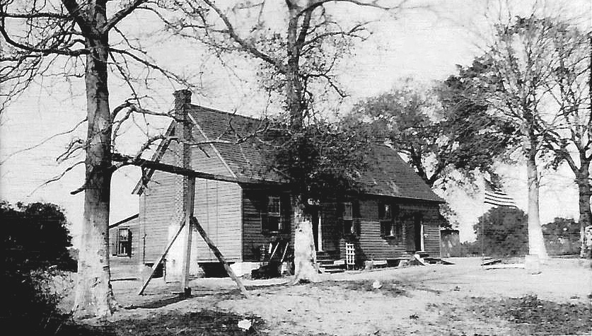
Society Corner School
Bur Clare Rd and Secessionville Rd.
Three Trees School was established as the only school for children who lived “down the island”. In 1926 Mrs. Fannie Greenwood was hired as the principal to improve learning conditions. She made sure students received a solid academic foundation, teaching black history and nurturing students’ self-esteem. Miss West, a volunteer from Florence, South Carolina, taught students for 40 years in the small black schoolhouse.
OUR CHURCHES
The leaders of the early Carolina Colony
encouraged religious tolerance. Settlers of
many faiths came to Charles Towne and
James Island. The first churches on James
Island were built in the early 1700s.
For more than 200 years, church has been
central to the community.
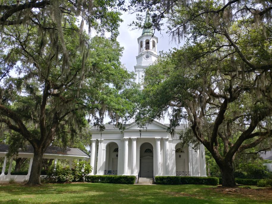
James Island Presbyterian Church
1632 Fort Johnson Road
Open for Sunday services
First constructed before 1724, James Island Presbyterian is locally known as Burnt Church because it accidentally burned around 1864. The current church has undergone many renovations but was built around 1909 in a Gothic Revival style. Burnt Church Cemetery is the final resting place of many notable James Islanders, including Samuel Smalls, the inspiration behind Porgie in George Gershwin's Porgie and Bess.
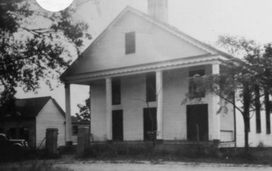
Saint James Episcopal Church
1872 Camp Road
Open for Sunday services
Saint James Episcopal Church is the oldest Anglican Church on the Island. It was established in 1719 and has been rebuilt five times! It has been destroyed by hurricane, fire, and war. The current building was constructed in 1960.

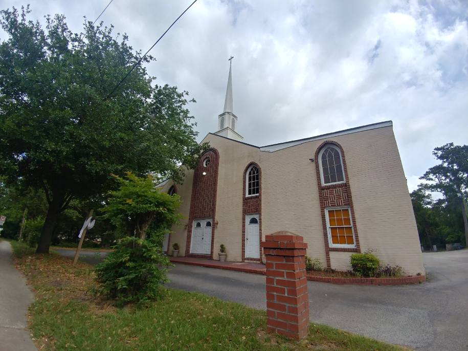
First Baptist of James Island
1110 Camp Road
Open for Sunday services
The First Baptist Church was established in 1869 by some faithful freedmen who held worship service at a house on what is now the corner of Camp and Dills Bluff Rd. The Ferguson family allowed the congregation to use the house until Reverend Green led the construction of the first wooden church building on the Camp Road site. The second church building was constructed in 1959 by Rev. Cooper Whaley, followed by the third building in 1985 led by Rev. Gadsden, Sr. The fourth and current church building was built in 2007, directly across the street from where the former church building known as the Landmark Center stands today.
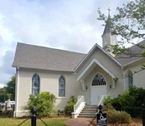
Saint James Presbyterian Church
1314 Secessionville Rd.
Open for Sunday services
Before the Civil War, enslaved people could not worship without supervision. Saint James Presbyterian Church is the oldest African American church on James Island. It dates from 1866. After the Civil War, freedmen initially worshipped under a tree on this property. Eventually they were able to build their own church.
Payne Reformed Methodist United Episcopal Church
1560 Camp Road
Open for Sunday services
Reconstruction brought some improvements in the lives of enslaved people. On the Seabrook Plantation, workers were given land rights to set up a “Bush Tent” for one cent a year for 99 years and here they established a place to worship. This informal group of worshipers became Payne RMUE in 1869 and in 1875 they built their first church building. It is one of the oldest wooden frame churches on the island.